Processing Tools
The processing tools provided by ORS Tools can be accessed either from the Processing Tools-tab in the main plugin GUI or from the QGIS Processing Toolbox.
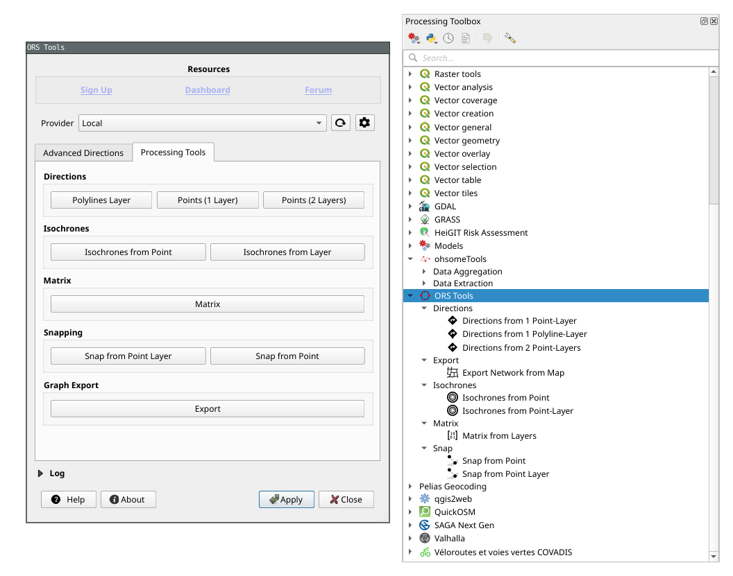
Available processing tools
Directions
Directions from 1 Point-Layer -
Points (1 Layer)
Calculate routes traversing the points in one Point-Layer.Directions from 1 Polyline-Layer -
Polylines-Layer)
Calculate a route that re-traces a line from a Polyline-Layer.Directions from 2 Point-Layers -
Points (2 Layers)
Calculate routes starting from points in a Point-Layer and ending in points in a Point-Layer.
Isochrones
Isochrones from Point
Calculate reachability areas from a single point.Isochrones from Layer
Calculate reachability areas from points in a Point-Layer.
Matrix
- Matrix from Layers
Calculate distance or duration matrix using starting points from a Point-Layer and ending points from a Point-Layer.
Export
- Export Network from Map
Export the graph network used by the openrouteservice for a given extent.
Snap
Snap from Point
Snap a single point to the routing graph.Snap from Point Layer
Snap points from a Point Layer to the routing graph.